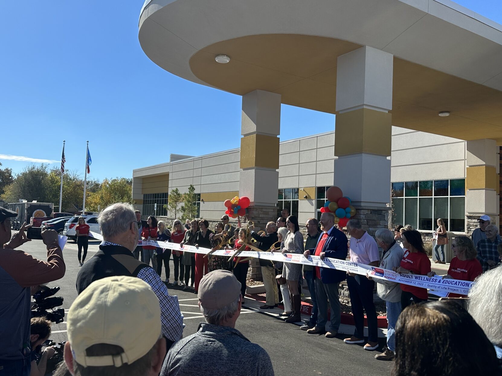
The City of Norman's Adult Wellness and Education Center ribbon cutting ceremony on Nov. 13.
...The National Weather Service in Norman has issued a Flood Warning for the following rivers in Oklahoma... Canadian River at Purcell affecting Pottawatomie, Cleveland and McClain Counties. PRECAUTIONARY/PREPAREDNESS ACTIONS... Turn around, don't drown when encountering flooded roads. Most flood deaths occur in vehicles. Additional information is available at www.weather.gov. The next statement will be issued this evening at 845 PM CDT. && ...FLOOD WARNING IN EFFECT FROM FRIDAY MORNING TO SATURDAY MORNING... ...REPLACES RIVER FLOOD ADVISORY... * WHAT...Minor flooding is forecast. * WHERE...Canadian River at Purcell. * WHEN...From Friday morning to Saturday morning. * IMPACTS...At 12.0 feet, Shallow flooding of low-lying areas occurs near the river on the Cleveland-McClain County border from near Noble... to areas south of Purcell and Lexington. * ADDITIONAL DETAILS... - At 7:30 AM CDT Thursday the stage was 6.2 feet. - Bankfull stage is 12.0 feet. - Forecast...The river is expected to rise above flood stage tomorrow morning to a crest of 12.4 feet tomorrow evening. It will then fall below flood stage early Saturday morning. - Flood stage is 12.0 feet. - Flood History...This crest compares to a previous crest of 12.5 feet on 05/08/2015. - http://www.weather.gov/safety/flood &&
...The Flood Warning is extended for the following rivers in Oklahoma... Canadian River at Norman affecting Cleveland and McClain Counties. PRECAUTIONARY/PREPAREDNESS ACTIONS... Turn around, don't drown when encountering flooded roads. Most flood deaths occur in vehicles. Caution is urged when walking near riverbanks. Additional information is available at www.weather.gov. The next statement will be issued this evening at 830 PM CDT. && ...FLOOD WARNING NOW IN EFFECT FROM THIS AFTERNOON TO LATE SATURDAY NIGHT... * WHAT...Moderate flooding is forecast. * WHERE...Canadian River at Norman. * WHEN...From this afternoon to late Saturday night. * IMPACTS...At 99.0 feet, Flooding to depths of 5 feet occurs over areas along and near the river on the Cleveland-McClain County border from near Moore and Norman... to areas near Noble. * ADDITIONAL DETAILS... - At 5:30 AM CDT Thursday the stage was 90.5 feet. - Bankfull stage is 94.0 feet. - Forecast...The river is expected to rise above flood stage late this afternoon to a crest of 98.7 feet early tomorrow afternoon. It will then fall below flood stage late Saturday evening. - Flood stage is 94.0 feet. - Flood History...This crest compares to a previous crest of 98.5 feet on 05/24/2015. - http://www.weather.gov/safety/flood &&
...Forecast flooding changed from Minor to Moderate severity and increased in duration for the following rivers in Oklahoma... Canadian River near Mustang affecting Grady, Canadian, Cleveland and McClain Counties. PRECAUTIONARY/PREPAREDNESS ACTIONS... Turn around, don't drown when encountering flooded roads. Most flood deaths occur in vehicles. Additional information is available at www.weather.gov. The next statement will be issued this evening at 830 PM CDT. && ...FLOOD WARNING NOW IN EFFECT UNTIL LATE SATURDAY NIGHT... * WHAT...Moderate flooding is forecast. * WHERE...Canadian River near Mustang. * WHEN...Until late Saturday night. * IMPACTS...At 25.0 feet, Widespread flood depths up to 3 feet occur along the river on the Canadian-Grady County border from near U.S. Highway 81 between Union City and Minco... to the areas near Tuttle and Mustang. Flooding may extend to the Ten-mile Flats area... downstream from Newcastle to near Norman. Sandpits... agricultural lands... and low-lying local roads are the areas most affected along the Canadian River. * ADDITIONAL DETAILS... - At 7:15 AM CDT Thursday the stage was 18.7 feet. - Bankfull stage is 22.0 feet. - Forecast...The river is expected to rise above flood stage this afternoon to a crest of 24.7 feet tomorrow morning. It will then fall below flood stage late Saturday evening. - Flood stage is 22.0 feet. - Flood History...This crest compares to a previous crest of 25.0 feet on 05/07/2015. - http://www.weather.gov/safety/flood &&
...FLOOD WATCH NOW IN EFFECT UNTIL 7 PM CDT THIS EVENING... * WHAT...Flooding caused by excessive rainfall continues to be possible. * WHERE...Portions of Oklahoma, including the following counties, Beckham, Blaine, Caddo, Canadian, Carter, Cleveland, Comanche, Cotton, Custer, Dewey, Garfield, Garvin, Grady, Greer, Harmon, Jackson, Jefferson, Kay, Kingfisher, Kiowa, Lincoln, Logan, Love, McClain, Murray, Noble, Oklahoma, Payne, Pontotoc, Pottawatomie, Roger Mills, Seminole, Stephens, Tillman and Washita and northern Texas, including the following counties, Archer, Baylor, Clay, Foard, Hardeman, Knox, Wichita and Wilbarger. * WHEN...Until 7 PM CDT this evening. * IMPACTS...Excessive runoff may result in flooding of rivers, creeks, streams, and other low-lying and flood-prone locations. Creeks and streams may rise out of their banks. Flooding may occur in poor drainage and urban areas. Low-water crossings may be flooded. * ADDITIONAL DETAILS... - Multiple rounds of showers and thunderstorms will continue through Thursday morning. Storms will include very heavy rainfall rates. Widespread additional rainfall amounts of 0.5-1 inches are likely, and a few locations will see additional rainfall of up 3 inches. - http://www.weather.gov/safety/flood PRECAUTIONARY/PREPAREDNESS ACTIONS... You should monitor later forecasts and be alert for possible Flood Warnings. Those living in areas prone to flooding should be prepared to take action should flooding develop. &&

...FLOOD ADVISORY IN EFFECT UNTIL 10 AM CDT THIS MORNING... * WHAT...Flooding caused by excessive rainfall is expected. * WHERE...Eastern Canadian County in central Oklahoma... Cleveland County in central Oklahoma... Grady County in central Oklahoma... McClain County in central Oklahoma... Oklahoma County in central Oklahoma... Northwestern Garvin County in southern Oklahoma... Northern Stephens County in southern Oklahoma... * WHEN...Until 1000 AM CDT. * IMPACTS...Minor flooding in low-lying and poor drainage areas. Ponding of water in urban or other areas is occurring or is imminent. * ADDITIONAL DETAILS... - At 646 AM CDT, Doppler radar indicated heavy rain due to thunderstorms. Minor flooding is ongoing or expected to begin shortly in the advisory area. Between 1 and 4 inches of rain have fallen since last evening, and up to 9 inches of rain have fallen since Wednesday morning. - Additional rainfall amounts up to 0.5 inches are expected over the area. Minor flooding impacts will continue this morning. - Some locations that will experience flooding include... Oklahoma City, Norman, Edmond, Moore, Midwest City, Duncan, Del City, Chickasha, Newcastle, Blanchard, Purcell, Marlow, Yukon, Bethany, Mustang, Choctaw, Warr Acres, The Village, Noble and Tuttle. - http://www.weather.gov/safety/flood PRECAUTIONARY/PREPAREDNESS ACTIONS... Turn around, don't drown when encountering flooded roads. Most flood deaths occur in vehicles. Be aware of your surroundings and do not drive on flooded roads. &&
news reporter
The City of Norman's Adult Wellness and Education Center ribbon cutting ceremony on Nov. 13.
Spencer Biasnews reporter
{{description}}
Email notifications are only sent once a day, and only if there are new matching items.
The city of Norman’s Adult Wellness and Education Center opened its doors during a ribbon cu…