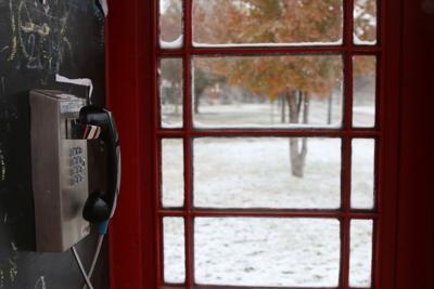

Colder-than-average temperatures and a strong pressure system gave Norman between two and four inches of snow Sunday, shutting campus down Monday.
The two to three inches of snowfall in Oklahoma City set a new record for the city that day, meteorologist Matthew Day said.
RELATED: UPB hosts free snow day movie marathon in Oklahoma Memorial Union
While the past week brought below-freezing high temperatures to Norman, normal or average high temperatures for the week are typically in the 50s, Day said.
However, this area of the country typically has a lot of variance within temperatures, so the cold snap isn’t particularly unusual, Day said.
Despite last week’s cold temperatures and Sunday’s snowfall, the wintry weather won’t likely carry over to this week, Day said.
Temperatures should rise throughout the week, reaching highs within the 50s and lows within the 30s by Thursday, Day said. By Saturday, meteorologists are predicting a chance of rain, Day said.
RELATED: What do you get when you cross 3 Sooners with roughly 1.5 inches of snow?
In the meantime, students should watch for slick roads Tuesday morning, as the temperatures may drop to the teens and re-freezing may occur, Day said.


