
WATCH: A second round of hail with heavy thunder and lightning has passed over OU’s campus. Read more at oudaily.com.
Pea-sized hail and heavy rainfall moving over Norman and OU’s campus. Read more at oudaily.com.
Severe thunderstorm warning issued for Cleveland County with potential for large hail and flash flooding. Read more at oudaily.com.
Severe storms and possible hail heading northeast toward Norman and OU’s campus. Read more at oudaily.com.
A tornado watch has been issued for Norman and OU’s campus with the possibility of strong winds and large hail. Read more at oudaily.com.
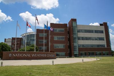
The National Weather Service issued a tornado watch until 11 p.m. for Cleveland County.
According to the National Weather Service, there is a low risk for tornadoes for northern, central and southwest Oklahoma and western north Texas on Monday afternoon and overnight.
There is a 30% chance of showers and potentially severe thunderstorms after 4 p.m. South winds are expected to be around 18 mph, with gusts as high as 25 mph.
Tonight, there is a chance of showers and thunderstorms, with likely showers and a possible thunderstorm after 1 a.m. Some of the storms could be severe. It will be mostly cloudy, with a low around 63 degrees and south wind from 10 to 16 mph, with gusts as high as 24 mph. There is a 70% chance of precipitation. New rainfall amounts between a tenth and quarter of an inch, except higher amounts possible in thunderstorms, according to the weather service.
Tornado watch vs. warning
• A tornado watch means be attentive because there is a possibility of a tornado forming nearby.
• A tornado warning means take shelter because a tornado has formed nearby.
RAVE, city alerts
• OU will send a RAVE alert if there is a tornado watch or warning near campus.
• RAVE alerts may be sent via text, email, social media or phone call.
• Emergency contact info for students, faculty and staff is pre-loaded in the RAVE system. To update or verify contact info, visit ecs.ou.edu.
• Norman residents can also sign up for emergency alerts through the city.
Preparedness tips
• Phones: Charge your devices in advance and be prepared to work without Wi-Fi in the event of a power outage.
• Updates: Pay attention to weather updates and have a shelter plan if a tornado warning is issued.
• Home refuge areas: Shelter spaces should be cleaned and have unobstructed entrances. Consider stocking them in advance with blankets, pillows, helmets, shoes and a safety kit.
• Safety kit recommendations: Bottled water, first aid kit, battery-operated flashlight, radio, charged cell phone and charger, non-perishable food, blankets, clothing, any required prescription drugs, eyeglasses, personal hygiene supplies, identification, insurance documentation
Shelter options
• On campus: All on-campus housing has shelter options. The shelters are only available to students. If told to “shelter in place,” do so in the building you are in when the warning is issued.
• Off campus: If you don’t live on campus seek refuge at home unless you are on campus when the warning is issued. OU buildings are not public storm shelters. Follow the “get in, get down, cover” strategy in an interior room on the lowest floor, and use a helmet and or blankets and pillows to protect yourself from potential debris.
• Norman sirens: The city of Norman may employ its outdoor warning sirens at times when an OU Rave text is not sent. In those instances, monitor local weather reports.
• Driving: Do not drive during a storm, and never seek shelter underneath a bridge or overpass. Get off the road and into the nearest building you can safely access for shelter.
Forecast
Scattered severe thunderstorms are expected from Monday evening into Tuesday morning.
This story was edited by Anusha Fathepure.


